New Orleans Maps
In a city shaped like a crescent, it gets tricky to find north, south, east or west. Below you will find our collection of helpful online and printable PDF maps of neighborhoods and local landmarks so you can make your way around New Orleans like a native during your next trip.
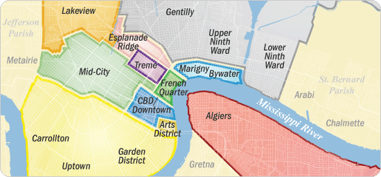
New Orleans neighborhood maps
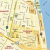
French Quarter
The French Quarter (or Vieux Carré) is the oldest neighborhood dating back to 1718.
Treme
Treme continues to preserve the traditions of African-American and Creole culture today.
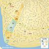
The Garden District
The Garden District is most known for its well preserved historic southern mansions.
Arts/Warehouse District
Following the 1984 World's Fair this area quickly began to flourish.
Algiers
This charming and primarily residential historic neighborhood is just a quick ferry ride away.
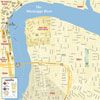
Uptown/Carrollton
Also called the Riverbend, this area contains several of the city's more prominent universities and parks.
Marigny/Bywater
This charming and bohemian area of the city is most known for its music clubs and nightlife.
SOURCE: http://www.neworleansonline.com/tools/transportation/maps.html